Geography
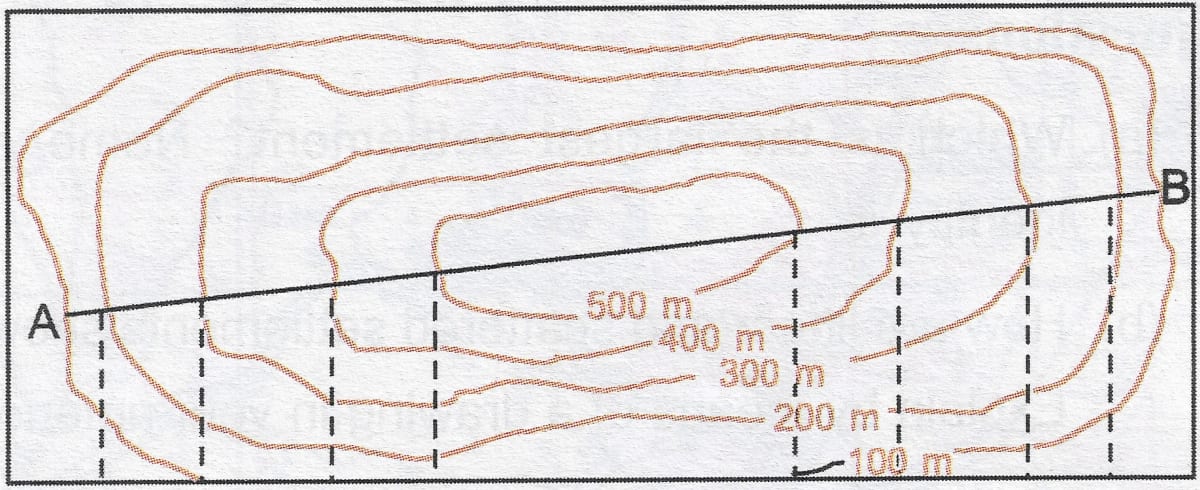
In what colour are contours shown on the map and what is the contour interval?
Geographical Features
43 Likes
Answer
Contours are shown with brown colour on the map.
The difference between the value of any two successive contours is known as the contour interval.
Answered By
26 Likes
Related Questions
Identify a gentle slope and steep slope by means of drawing contours in your notebook in brown colour.
Why is Anadra an important town? State its favourable features (any 2).
Identify the following relief features (landform) shown by contours on the given topographical sheet G43S10 on page 22.
(i) Conical hill, gentle slope, steep slope, a saddle, col and pass.
(ii) Find out the contour interval in the given toposheet.
(iii) Identify (a) Nuclear settlement, (b) linear settlement and (c) scattered settlement.
Identify and name the relief feature represented in the given diagram: